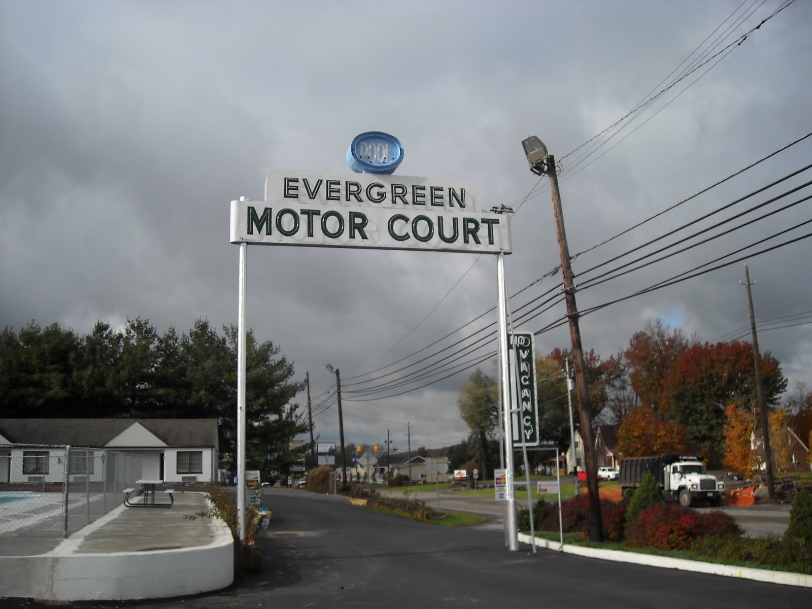
I haven't posted in a couple of weeks. I bought a new computer, and setting it up has been very time-consuming. But look at this neon sign! And the name of the place: "motor court." Not "motel," nor any of the cute terms that are used by expensive chains. This motor court is on US Route 11, just north of Bristol VA. I stayed here in late October on my way to western North Carolina. My total bill was exactly $30.00, after using a coupon. And they had wireless Internet!
A blog dedicated to the pursuit of all roads in the United States except Interstates
Monday, November 23, 2009
Sunday, November 8, 2009
Winding Stairs, Nantahala Gorge, Western NC
Here are two scenes from the Winding Stairs in western North Carolina. To make things confusing, there are two places with Winding Stairs in their name. This is not near Winding Stair Gap on US 64 and the Appalachian Trail.
This Winding Stairs is a narrow gravel road that begins in the bottom of the Nantahala Gorge on US Routes 19 and 74. It climbs out of the gorge through some incredible scenery. The fall colors were beautiful when I drove up this road on October 31, 2009. The view above is looking back down into the Nantahala Gorge about halfway up the mountain.
The view below explains why this road is called Winding Stairs. The road that you see far down the mountain is the same one that I was standing on to take the picture. You don't want to drive fast on this road. As you can see, there are no guard rails, and it can be a very loooong way down.
The road goes around a man-made lake near the top of the mountain and joins a paved road that will take you back down to 19/74.
This is a spectacular but very obscure scenic drive in western North Carolina.
Thursday, October 29, 2009
Christiansburg Wayside, Routes 460/11 VA
Before interstate highways were built in Virginia, the state opeated a system of "waysides" on most of the primary highways. These were similar to the rest areas that you find on Interstates today. I remember seeing a few of them as a child. Most of them no longer have restrooms, but they still have picnic tables. This is the Christiansburg Wayside on US Routes 460 and 11 just north of the town of Christiansburg. It's perched at the top of Christiansburg Mountain, and hence on top of the Eastern Continental Divide. Interstate 81 takes ten miles to ascend Christiansburg Mountain. 460/11 makes the climb in about one mile. It's steep, but I've seen steeper hills.
Monday, October 19, 2009
Hidden Shangri-La in Southwestern Virginia
Burke's Garden is not a place you'd stumble on by accident. It's a beautiful, isolated agricultural valley 3000 feet above sea level. The closest other town is Tazewell VA. There is one road, VA secondary 623, that accesses the area. Coming from the south, it can be harrowing. Above, see the road you're standing on as it winds down the mountain.
Burke's Garden is flat but ringed by mountains on all sides. Below are three scenes on the valley floor.
The easiest way to reach Burke's Garden is from Virginia Route 61. About five miles from the town of Tazewell, turn south on secondary 623. This road bisects the valley, becomes a gravel road, and winds over Garden Mountain to end at Virginia 42.
Saturday, October 17, 2009
State Park Reveals Its Commercial Tourist Attraction Past
This is a view of Caesar's Head at Caesar's Head State Park, South Carolina. Someone thought that rock looked like old Julius or Augustus. The park may be found on winding, twisting US 276 north of Greenville.
The state park was once a privately operated roadside tourist attraction. There is telltale evidence of that heritage in the two photos below. In the left photo is one of those coin-operated telescopes that you found at any attraction in the mountains. I never knew what I was looking at through one of those things.
The photo to the right shows a cleft in the rock with a sign reading "Devil's Kitchen." Commercial tourist attractions liked to give cute names like that to various rock formations. The best examples of this are at Chimney Rock and Rock City.
Wednesday, October 14, 2009
Spring from Pipe near Glen Lyn VA
I discovered this little oddity the other day while driving along a gravel road in Giles County, Virginia. I have no idea how the spring got there; it was in a patch of underbrush next to the road. There was no house or other building in the immediate vicinity.
I found it on East River Mountain Road, a few miles from the town of Glen Lyn. The road starts on US Route 460 between the Exxon station and the power plant. It winds around on the side of a mountain before dropping back down to Lurich Road next to a one-lane railroad underpass.
Sunday, October 11, 2009
Wind Rock, Jefferson National Forest VA
You have to really love back roads to even know about this place. It's called Wind Rock, and it's deep in the Jefferson National Forest in Giles County, Virginia. Take US 460 west of Blacksburg almost to Pembroke. Turn right on VA secondary 613 and follow it all the way up to Mountain Lake Hotel, made famous by "Dirty Dancing." 613 turns left and quickly becomes a gravel road. Just before the road starts going down again, there's an open area to the left where you can park. Look for the white blazes of the Appalachian Trail and walk to the right of the road (trail-wise north). The rock is about a quarter of a mile up the AT, to your left. It's uphill, but the path is smooth.
Except for one house that probably isn't showing up on the photo, there is absolutely no sign of human habitation visible from Wind Rock. Nearly all of it is in the Jefferson National Forest.
A note on route numbers: Virginia secondary highways are numbered in the 600s and 700s. These numbers repeat themselves in each county, so if you see another Route 613, it isn't the same one unless you're still in Giles County.
Subscribe to:
Posts (Atom)


